Wednesday, March 11, 2015

Land Surveying: Must Have Apps

 This list is apps I use almost on a daily basis. I hope you enjoy this list as all of these apps have worked great for me and I know they will for you to.
VOXER
 
Will the android/ iphone app Voxer replace two way radios in surveying. In short I believe so, Voxer is a app in the play store and app store that will turn your smartphone into a walkie talkie. Anywhere you have service it will work. I use this app religiously to keep up with co-workers at our many offices, to communicate with my supervisor, and to keep track of my crew. For example this app comes in handy while running a total station or when two crews are on the same job but miles apart. There are countless use for this app in the survey industry. So give the app a try. what do you got to lose after all it is free.
TINY SCAN
 
Tiny scan is another app available on the play store and app store. It turns your ordinary smartphone into a powerful scanner.This app has countless uses in the survey industry. For example, when I go outta town I hate carrying loads of equipment, it just takes up more room in my work truck. But with this app I can leave that bulky scanner behind. To use the app simply tap on tiny scan and take a picture of your field notes for example. The app will convert that picture into a PDF scan and then you can just email it out directly from the app. That easy, its so easy a 2 year old can use it.
 
GOOGLE MAPS
 
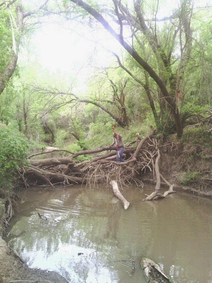
Google maps is one of my all time favorite apps for use in surveying. Not only can you navigate with it but you can compare aerials between the maps you've been given and the hybrid aerial on the phone. It's extremely useful when trying to figure out which part of a creek or wooded area your in.

PDF CONNECT
 
PDF connect is awesome because it lets you download any email attachment and sign it with your finger. For example my company sends out weekly safety topics that require us to sign them and send them back and instead of printing and rescanning the form, I simply grab it from my email put my name on it the simply endorse it with my finger then I just email it out directly from the app. It literally takes 2 minutes to complete and send. The only downfall with this app is as far as I know it's only on the iphone.

COMPASS
The compass that comes with your smartphone is also a very useful tool in surveying. Everyone should always know where north is on every job that they arrive on. This app also comes in handy when trying to teach anyone to stake to a point with the GPS. I always teach new hires one thing, every job we go on know where north is. This is very crucial in surveying.

Now that I've given you some of the apps I use, what are some of the apps that you use to make your job easier or more efficient? Leave them in the comments below and lets help each other put together the best apps list for the survey industry!!!

Monday, March 9, 2015

Survey Field Notes

Field notes can say alot about a person. For example if your field notes are sloppy and unreadable, cad techs and whoever else views them may have a hard time following exactly what you did that day. Great written field notes are essential. A cad tech will follow those notes when they are creating plats and etc... for the client. So the easier to read the better. For example here's how I do my field notes.
As you can see a 10 year can understand these notes. In the header I put the job number, filename from the DC, client info, the county and state i'm working in, and finally what I'm doing that day. Easy enough right? After the header I always put my GNSS base and my check shot, also what I forgot to put on there were my deltas (horizontal and vertical residuals which I put next to my check shot). Then I put my point numbers with a description for each point range or shot. On the right of the page I put my crew names and there appropriate job symbols (PC=party chief and the other symbol is instrumentman). If I used a atv for the day I also put it down with the atv number. Then I write the GNSS survey equipment I'm using along with the date and the weather conditions. Make note of my drawing, you should always do a drawing of what you did for the day even if you did not have any data.I also try and put all my point numbers in the appropriate spots on my drawing. You dont have to put every single point number down, but make it to where they can understand them. Remember make your notes legible, descriptive, and always do a drawing. The more understandable your notes the less your bothered with unneeded questions about them.

Land Surveying Spells Adventure

Surveying is one of the best careers you can get into. I started surveying with my dad when I was only 13 years old and boy at that time I didnt realize the many adventures and situations I would get into. I started out in residential and commercial surveying which I loved, but I always longed for more adventure. What better way to get into an adventure then oilfield surveying. And make no mistake when I say adventure I mean it. Ive seen so many exciting things as a oilfield surveyor. Traveling is a great part of the job. Getting to see different places is awesome. I've been to Pennsylvania, Mississippi, New Jersey, Maryland, Louisiana, New Mexico, and all over the great state of Texas. As a matter of fact I met my wife when I was working on a pipeline down in south Texas.
 Now for the good stuff, I've literally almost stepped on rattlesnakes, cottonmouths, and copperheads. I,ve been chased and tree'd by hogs. I've been in bayous getting topo shots and gators have popped up right next to me curiously just watching my every move. And yet all of this is still better than sitting in an office working a boring 9 to 5 job. There is no better place than being in the great outdoors, seeing new place and playing with the wildlife. You dont need to spend money for an adventure just become a surveyor, trust me if you like working outdoors this is the job for you. Do you need a degree to become a surveyor NO,just look up the nearest surveying company and go apply as a rodman. You to can have the adventure of a lifetime.

 Below are some pics I thought you all might enjoy!!!

Trimble TSC3 Data Collector

To start a new job on your TSC3 tap on the jobs tab and it will take you to a screen with multiple tabs.
You want to click on new job. Now you will give your job a name, most companies are different in how they require you to do this.
For example this is how I do my jobs everyday 030915TF. As you can see I put the date and then my initials. I do this for two reasons and the first reason is if a tech or anybody calls and ask a question about the job I can go into my DC and find the job they are asking about on that date. secondly by putting my initials they know thats my job file, as some companies may have 10 or more crews turning in data everyday. For them knowing whos data is whos is crucial. Anyways next you need to set your coordinate system up. Click on the tab next to cord system. Tap select from library then hit next.
Now your gunna set the system you will be working in NAD27 or NAD83 etc... I use NAD27 so i'll tap on US State Plane 1927. Next set which zone you are working in, which i'm in the Texas Central Zone so i'll tap on Texas Central 4203. Your company should already have your geoid model and datum grid setup in your collector. If they are not setup get with your supervisor to have them installed on your collector. And thats it, You've successfully created a new job in your Trimble TSC3 data collector. "One more not is that the Trimble TSC2 data collector is pretty much setup the same way as the TSC3s"

Sunday, March 8, 2015

Texas State Planes

We will start out with the basics “Texas state planes”. This is very important to know for many reasons but the main reason I want you to know it is because its important in starting a new job in your data collector. If you look at the picture the blue zone is the Texas South zone. The green zone is the Texas south Central zone. The yellow zone is the Texas Central zone. The purple zone is the Texas North Central zone and last but not least the red zone is the Texas North zone. It’s very important to know which zone you are in before starting a new job in your data collector.